Forestimator Mobile? Your New Forest Mapping Tool
Forestimator is a geoportal launched in 2022 by their researchers.
It is used to distribute the maps produced by foresters and provides a full description of forest sites and stands for the whole of Wallonia.
Users can view and download these maps, as well as guides to Ardenne forestry sites and descriptions of the different site units. Initially designed for use on a computer via a web browser (https://forestimator.gembloux.ulg.ac.be/), Forestimator is now adapting to new working habits thanks to a mobile application.
Forestimator Mobile (https://play.google.com/store/apps/details?id=com.forestimator&hl=en) aims to offer the same functionality as the web version, while providing a more fluid and simplified user experience. The development of this application is planned in several phases.
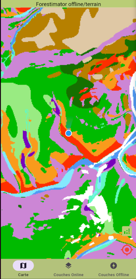
An initial version for Android has recently been made available via the Google Play Store. This version allows users to instantly obtain detailed information on forest stations and stands using their smartphone's geolocation.
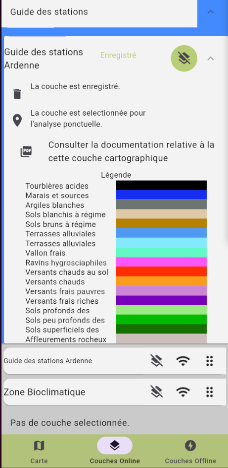
Users can access a wide range of data, such as the soil code, water and trophic levels, altitude and the predominant species in the stand. What's more, each map layer is accompanied by documents that can be consulted in the field, even without an internet connection.
The second phase of development, scheduled for 2025, will focus on improving the Android version and rolling out the application for iOS systems.